LiveClient delivery · real estateShort case
Interactive 3D Property Map
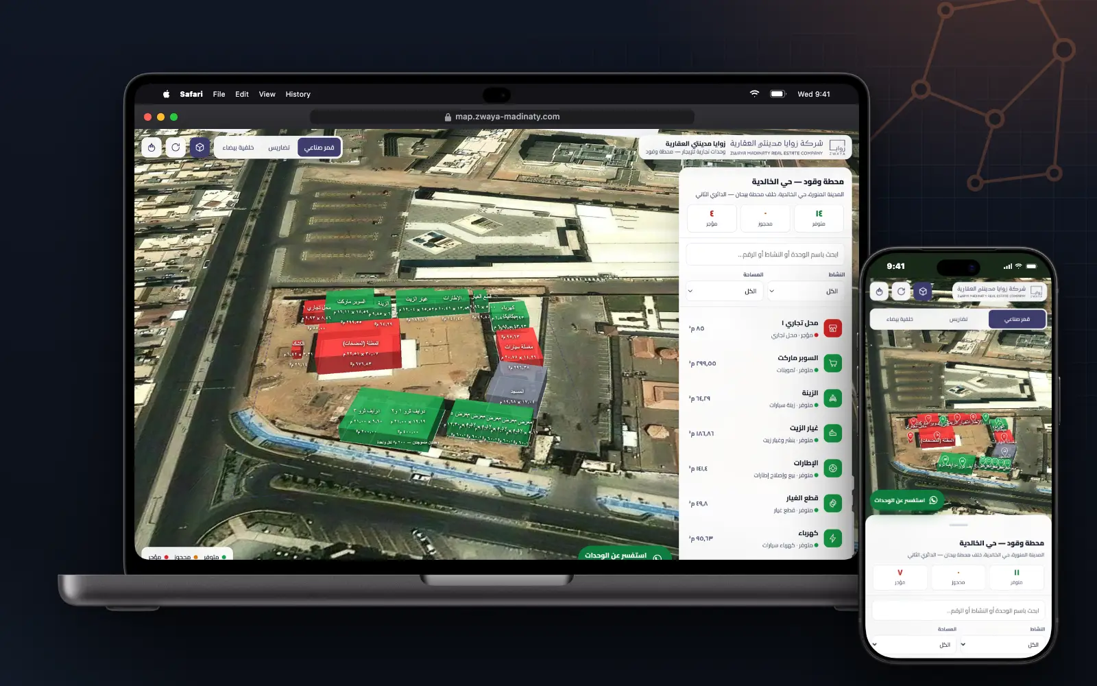
The commercial units of a fuel station in 3D over satellite imagery — with boundaries measured from the site plan, not traced by eye.
0.05%calibration error on both surveyed plot edgesHow this was measured
Station geometry calibrated against both surveyed plot edges — 191.80 m and 162.20 m — and stored in metres in the plan’s own coordinate space.
01The problem
Unit boundaries traced by eye over satellite imagery look right and measure wrong. A leasing map has to agree with the plan the units are leased from.
02Geometry from the plan
The station geometry was extracted from the CAD site plan, calibrated against both surveyed plot edges — 191.80 m and 162.20 m — to within 0.05%, and stored in metres in the plan’s own coordinate space.
Measured footprints land within 0.0 to 1.2% of the declared areas: supermarket 299.03 vs 299.55 m², canopy 676.58 vs 676.83, car wash 296.32 vs 296.38.
03The map
Units are drawn in 3D and coloured by status, with a searchable list and filters. Opening a unit shows its area, dimensions and lease terms, suggested alternatives, and call and share buttons. On a phone, the map sits above a sheet with unit counts, search and filters.
04Built to run anywhere
PHP 8 with SQLite: no external database, no Composer, no Node, no build step and no paid map key, so it deploys on any shared hosting.
A password-protected admin panel manages unit status, pricing and contact data. The first-run admin password is random, written to a file the operator deletes after use, and must be rotated on first login; sign-in attempts are limited.
Handover included a printed user guide for the map and a deployment guide.
05Screens6
06What you can check yourself
Each row is a source you can open or a method you can repeat.
- Livemap.zwaya-madinaty.com↗
- Measured0.05% CAD calibration errorStation geometry calibrated against both surveyed plot edges — 191.80 m and 162.20 m — and stored in metres in the plan’s own coordinate space.
- Screens6 screens
Talk about this project
For judges, mentors and security teams — WhatsApp and email reach me directly, and I reply myself. Open to mentorship and cybersecurity programmes.